Exit Forum › Forums › Kimberley Coast Boating Forum. › General Interest › Cyclone shelters
- This topic has 4 replies, 2 voices, and was last updated 5 years, 3 months ago by
Ross. This post has been viewed 1657 times
-
AuthorPosts
-
-
17/01/2019 at 9:45 pm #2789
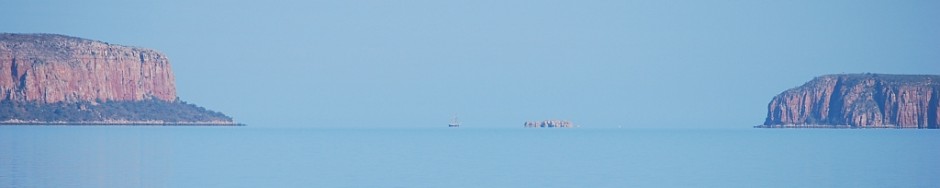
Gday . Would be interesting to get people’s thoughts, ideas, contingency plans etc on what would be considered the best cyclone hidey holes, shelters, creeks, rivers etc in the eastern Kimberley, The king George river for example with its high sandstone cliffs I thought would be an obvious choice, maybe the Drysdale river in Napier Broome bay and what about the palm island area. What do the pearl farms, fishing camps etc do A dedicated page maybe. Cheers Steve
-
18/01/2019 at 5:33 pm #2791
Hi Steve, One of our members just gave me a Cyclone Plan he wrote prior to the 2018/19 wet season. They have just spent about 2 months in the Kimberley diving on reefs for research, and are currently diving the Money Shoal, north of Cape Don. Apparently the wet season has calmer weather for off shore diving.
His insurance company required the written Cyclone Plan before they left Queensland for WA waters last year.
I intend to publish it on this website. But I want to do it so others can make comments and add to the document. When I figure out how to do that’ I’ll get it up on a dedicated page like you suggest. I’ll post a reply to this topic when I get it published.
I’ve not been through a cyclone at sea, but I know people who have, and the general opinion is to get into a mangrove creek where the boat can be tied off in all directions to mangroves with big strong trunks and high foliage.
I think the big rivers with high sides, such as the King George and the Berkeley would still get very blowy, and it would be hard to anchor, or tie off the boat to the banks to prevent the boat getting blown onto the river banks. But I’m happy to be contradicted if someone has already done it successfully. There’s a protected inlet in the King George, just west of BarBQ beach that might be suitable. Shallow draft vessels could get in there at high tide. From memory there are trees and mangroves surrounding the inlet.
The Drysdale River has a number of narrow creeks, with high mangroves that may be suitable. But parts of the creeks are very shallow and I’d want to explore in the tender to find a hole with some depth to anchor in.
Cheers, Ross
-
19/01/2019 at 5:29 pm #2792
Gday Ross A written cyclone plan, that’s hilarious, I Wonder what satisfies there “ cyclone plan “ requirements, Found a good read a while back svsarean.com surviving cyclone Debbie on there blog page. I guess the jury’s still out as to whether or not the high cliffs, narrow ( gorges) would offer up any real protection,no dought it would still get a bit windy, but not to bumpy if that makes any sense, a big kahuna reef pick or Manson plough anchor depending on what type of bottom and some 20 ml rope and chain, I’d be willing to give it a go. I’m guessing that’s what ray and barbs plans were whilst caretaking faraway bay was to go up into king George. Cheers. Steve
-
20/01/2019 at 3:18 pm #2793
Hi Steve,
Ray and Barb pretty much permanently tie their boat in a mangrove creek during the wet season so they don’t get caught short. Similar creek to where SV Sarean was during Cyclone Debbie.
One of the problems with the big rivers, is that the fresh water flow speed and water level from storms can increase enormously in the wet season, which in its own right could make anchoring difficult, particularly if sea water storm surge is pushing the tide up the river. I’ve seen debris about 8-10 meters above the dry season water level, up trees near the Berkeley River rock bar. The small creeks don’t get the water surge problem to the same degree.
My only experience with a cyclone was in Escape River, FNQ, in November 2007. We sailed into the river to shelter from cyclone Guba, which was heading towards Cape York. We had a friend on board who is a very experienced commercial fisherman in the NZ, WA, FNQ and NT waters, and knows his stuff when it comes to bad weather. We anchored about 3 miles up the river, but he reckoned we wouldn’t stand a chance anchored there if Guba came close to us. We soon sussed out a creek, just wide and deep enough to get R&R into. It had old, high mangroves with hefty trunks. The perfect cyclone hole, according to our friend. Luckily we didn’t have to use it. Guba headed up to PNG, unfortunately killing about 200 people. We were lucky.
I’m working on how to publish the cyclone plan.
Cheers, Ross
-
24/01/2019 at 4:42 pm #2829
The Cyclone Anchorage Document is now on this website at https://kccyc.org.au/blog/2019/01/20/cyclone-preparation/
We’re seeking comments and feedback from experienced sailors who can offer advice and constructive comment, which can be used to review and refine the document. We will then either change, or add comments to the document to update it when appropriate. We would particularly like your ideas and advice on the suitability of the cyclone anchorages shown in the document, and any other cyclone anchorages you are aware of.
Cheers, Ross
-
-
AuthorPosts
- You must be logged in to reply to this topic.